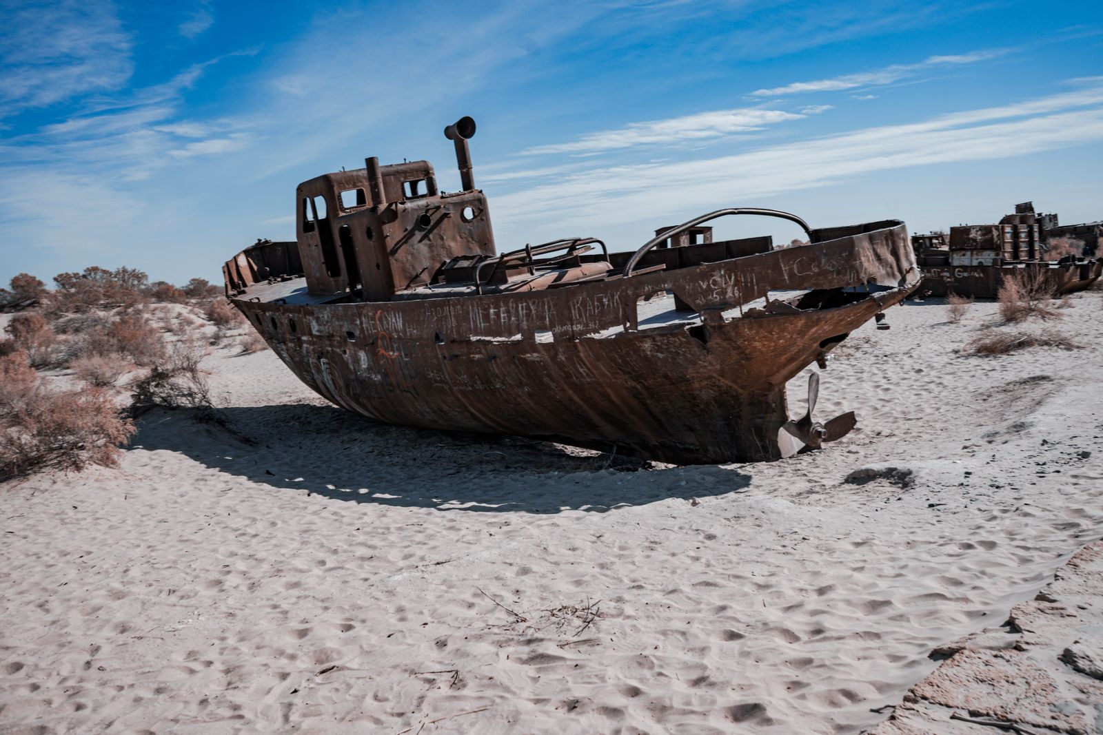
The Kokaral Dam is an earthen barrier stretched across the narrow channel that once connected the northern and southern halves of the Aral Sea, and since its completion the water level in the North Aral has risen by roughly four metres, salinity has dropped by more than half, and commercial fishing has returned to Kazakh villages that spent two decades looking out at nothing but salt flats and rusting trawlers. The project was built with World Bank support alongside the Kazakh government, and it did something almost no other large-scale ecological restoration has managed: it partly undid one of the twentieth century’s most complete environmental collapses.
The mechanism is almost embarrassingly simple. Block the Berg Strait, the shallow neck between the two lobes of the sea, and the Syr Darya river — which still flows into the northern half from the Tian Shan mountains — can no longer bleed south into the dry southern basin. The water accumulates. The sea rises. Fish come back.
The disaster the dam was built to reverse
The Aral Sea was one of the world’s largest lakes, straddling the border of what is now Kazakhstan and Uzbekistan. It supported a major fishing industry. Then Soviet central planners diverted the two rivers that fed it — the Amu Darya from the south and the Syr Darya from the north — into an enormous cotton-irrigation network across the Central Asian steppe.
The sea had no other significant inflow. Evaporation kept working. Inflow did not. Within decades the Aral had lost the vast majority of its volume and split into isolated fragments, and the exposed lakebed had become the Aralkum, often described as the world’s youngest desert. The collapse became recognized as one of the century’s most severe environmental disasters.
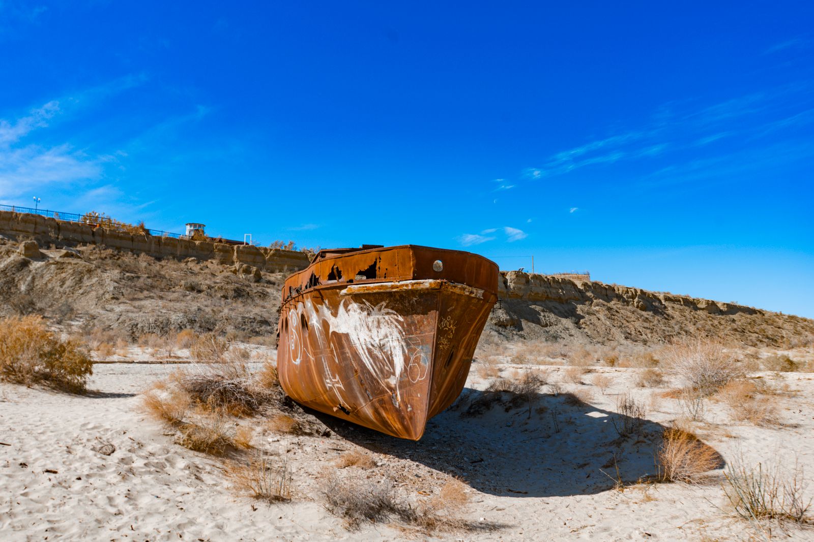
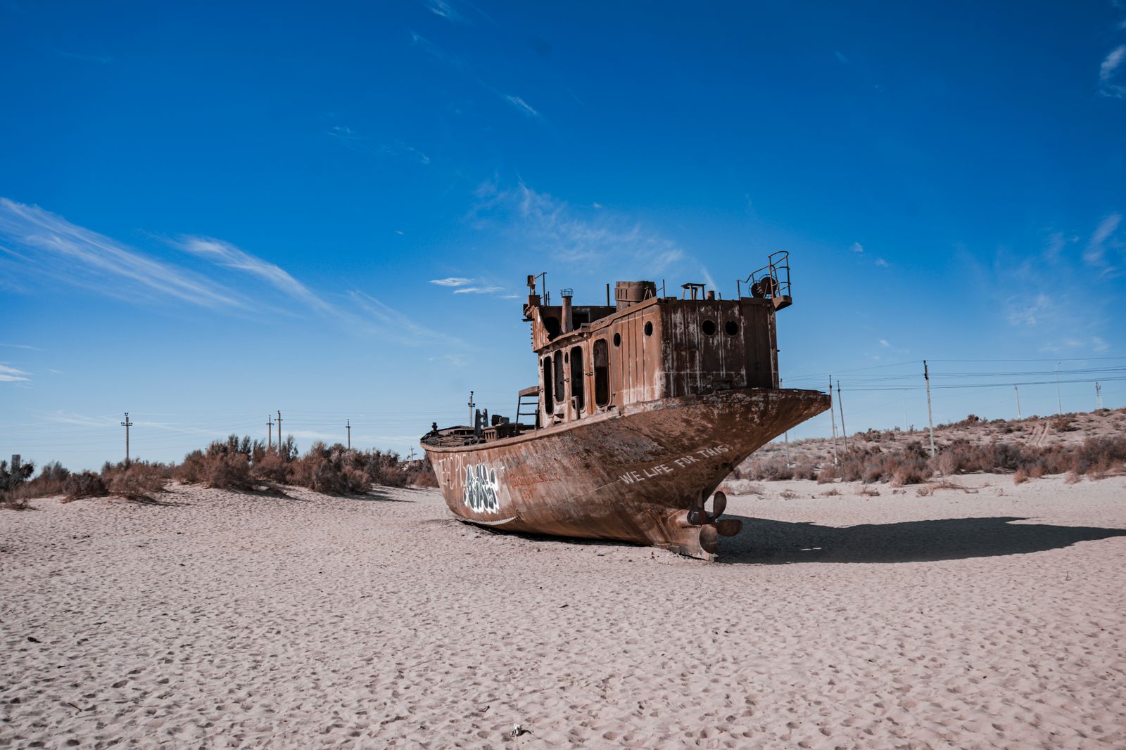
Ports like Aralsk, once a fishing town on the Kazakh side, ended up stranded far from water. Trawlers were left where they had last floated. Dust storms carrying salt, pesticide residue and defoliants blew off the exposed seabed and into villages hundreds of kilometres downwind.
Why a dam, and why there
By the late 1990s the northern lobe — smaller, shallower, and still fed by what was left of the Syr Darya — was the only part of the sea with any realistic prospect of recovery. The southern basin in Uzbekistan had lost its river almost entirely to cotton fields and would keep evaporating regardless of what anyone built.
Kazakh engineers, working with the World Bank, chose the Berg Strait because it was the pinch point. A narrow, shallow channel meant a shorter, cheaper dam. Every cubic metre of Syr Darya water that had been slipping through the strait into the doomed southern basin would now stay in the north.
The Kokaral Dam is not a hydroelectric structure or a concrete arch. It is a low earthen embankment with a spillway that lets excess water escape south when the North Aral rises above a set level. That’s it. The engineering is closer to a levee than to Hoover Dam.
What happened after 2005
Predictions before construction had been cautious. The dam was expected to raise the North Aral by around three metres over several years. Water arrived faster than modellers thought. Within the first year of the spillway closing, the level had climbed several metres, and the sea rose approximately four metres and expanded considerably.
Salinity, which had climbed to levels approaching seawater, dropped significantly in the deeper reaches. That is the number that matters for fish. Freshwater and brackish species that had been extirpated locally could once again survive.
Kazakh authorities restocked pike-perch, bream, carp and, crucially, flounder. Fish catches, which had collapsed to essentially zero in the 1990s, climbed back into the thousands of tonnes per year. According to reports, the dam’s construction led to job creation and encouraged former residents to return to traditional fishing areas, bringing renewed hope to the region.
Aralsk, the old port, is still not on the water. But the sea, which had retreated far from the town at its lowest point, has advanced back considerably closer to the harbour. Trucks now haul catch from smaller fishing settlements along the new coastline to processing plants in Aralsk that had sat idle for a generation.
The numbers, and what they mean in scale
The North Aral restoration is real, but it is restoration of a fragment. The southern basin at its peak held far more water. Restoration here addresses only the northern lobe.
Follow-up projects have been discussed between Kazakhstan and the World Bank to further raise the Kokaral Dam, which would increase the North Aral’s volume further over several years.
Small structural changes at a pinch point can produce large hydrological effects.
What the dam did not fix
The southern Aral, sitting in Uzbekistan, is essentially gone. The Amu Darya rarely reaches it. The exposed seabed continues to produce toxic dust storms that carry salt and residues of Soviet-era agrochemicals across the region. Kazakhstan and Uzbekistan have planted saxaul trees — a drought-tolerant desert shrub — across sections of the Aralkum to stabilise the soil and cut down on airborne dust, but the reforested area is a small fraction of the exposed bed.
Water consumption across Central Asia is still rising. The vast majority of the region’s water still goes to agriculture, and losses inside irrigation systems remain high. Cotton and rice, both extremely thirsty crops, still dominate the fields the Soviets designed the diversion canals to feed.
The Kokaral Dam is a workaround, not a solution to the underlying accounting problem: too much withdrawal, too little inflow. It saved what could still be saved. It did not restart the rivers.
Why this matters beyond Kazakhstan
Lake Chad in Central Africa has lost most of its surface area over recent decades. Iran’s Lake Urmia has shrunk dramatically. Utah’s Great Salt Lake has been declining. Each of these is, at its base, the same accounting problem the Aral had: withdrawal outpacing replenishment, sometimes accelerated by warming and shifting rainfall.
The Kokaral Dam is the closest thing the world has to a demonstration that a shrinking terminal lake can be, in part, brought back. Not with a policy paper. With a river, a wall, and enough patience to let evaporation lose the arithmetic race for a change.
Restoration work on rivers elsewhere has produced smaller, more localised versions of the same lesson. Removing barriers on the Klamath in the American West has begun to reopen salmon runs blocked for a century, and tribal nations have been central to the political work of getting that restoration approved. Migratory fish return quickly when the physical obstacle is removed or, as at Kokaral, when the water depth and salinity that once supported them are restored.
The reverse is also documented. A recent Mongabay investigation into Sri Lanka’s so-called “fish rain” phenomenon found that rising dams across the island are blocking the migration corridors that historically moved fish between wet-season floodplains and dry-season refuges. Dams giveth, dams taketh away, depending entirely on where you put them and what you are trying to hold or release.
The energy connection, and the cost of doing nothing
Central Asia’s water and energy systems are tangled together. Upstream countries — Kyrgyzstan and Tajikistan — control the headwaters and want to release water in winter to run hydropower for heating. Downstream countries — Uzbekistan, Turkmenistan, Kazakhstan — want water held in reservoirs and released in summer to irrigate crops. The Aral has been the terminal casualty of that unresolved argument for sixty years.
Energy Daily has previously covered how shifting water availability changes the calculus for hydropower and cooling water in grids dependent on large reservoirs. The lesson from the Aral is that the water-energy-food trilemma does not respect national boundaries, and a single well-placed piece of civil engineering can either lock in the damage or partly reverse it.
Kazakhstan is now weighing a second-phase Kokaral raise, deeper river-channel dredging on the lower Syr Darya, and additional restocking. Uzbekistan, which lost the southern sea, is focused on stabilising the Aralkum and on saxaul planting. Both countries have engaged in diplomatic efforts around Aral Sea restoration, though transboundary water agreements remain challenging.
A sea rebuilt one metre at a time
Two decades after the spillway closed, the North Aral is stable, ice forms on it in winter thick enough for fishermen to work through, and the fish auction in Aralsk runs several days a week. The southern basin remains a desert. The rivers that fed both are still overdrawn.
Editorial coverage on this beat has previously looked at slow-motion Arctic biology — the Greenland shark, whose lifespan runs to four centuries — as a reminder that ecological time and human time run on different clocks. The Aral operates on both at once. It took decades to drain it. It took months, once the dam closed, for the water to start climbing back.
The trawlers still sit in the Aralkum south of the Berg Strait, tilted on the salt, far from any coast. On the Kazakh side, though, the horizon is water again, and the boats going out from Tastubek and Bugun this summer are hauling in flounder that, by any reasonable expectation twenty-five years ago, should have been extinct in this basin forever.