Raytheon announced Tuesday it is performing space-qualified vacuum testing on a prototype of the Visible Infrared Imaging Radiometer Suite, a key instrument in NOAA's National Polar-orbiting Operational Environmental Satellite System.
VIIRS is one of the most advanced weather-imaging sensors ever produced. Raytheon said in a statement that the VIIRS prototype – called an engineering development unit – is in the third and final stage of testing expected to be completed by mid-summer.
Raytheon's Space and Airborne Systems division is testing VIIRS under a subcontract to NPOESS prime contractor Northrop Grumman. SAS will deliver three flight units, with options for four more.
VIIRS will collect visible/infrared imagery and radiometric data on the atmosphere, clouds, Earth radiation budget, clear-air land/water surfaces, sea surface temperature, ocean color and low-light visible imagery. The sensor will offer improved spatial, spectral and radiometric performance compared with current remote-sensing systems.
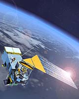
NPOESS is the next-generation, low-Earth-orbit environmental satellite system for the United States. It comprises satellites, sensors, a ground-control system and a data-processing and data-dissemination network.
NPOESS will provide civilian, military and scientific communities with regional and global meteorological data, as well as oceanographic, environmental, climatic and environmental remote-sensing information. It also will conduct surface data collection and assist in search and rescue efforts.
