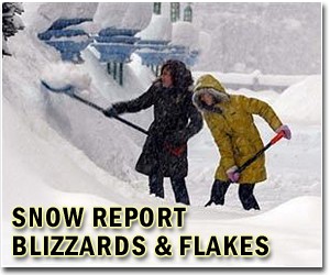
US weather experts were Saturday congratulating themselves on predicting almost down to the last inch the pattern of a record-breaking storm that crippled the east coast.
And they warned that more snow showers are likely to follow next week.
"This kind of storm puts us to the test, to see whether we can assess such extreme patterns accurately," winter weather expert Paul Kocin told AFP.
The monster storm, which bore down on the east coast, stretched from eastern Indiana across to New Jersey and south through Maryland, Virginia and into North Carolina.
Kocin said that for several days the experts at the National Weather Service had accurately tracked the storm front and provided early warnings that it was going to wallop the region with more than two feet (61 centimeters) of snow.
And they said — correctly, it turned out — that the blizzard would miss New York, a city more used to getting such wintry weather than the US capital Washington, parts of which were blanketed under 20 inches (51 cm) of snow.
Meteorologists have used computers for decades to predict the weather, but improvements in technology, such as greater computer processing power, better Doppler radar scanning and 3-D imagery, and more accurate mathematical modeling have led to drastically improved forecasts.
The developments have helped meteorologists extend warning lead times to communities ahead of severe weather events such as this weekend's monster storm.
"To be able to do this with that kind of precision showed something worked really well," Kocin said, highlighting the early warnings had given emergency services time to prepare.
He warned it was possible more snow showers could develop next week, but said meteorologists first had to wait for the current storm system to blow over and out to sea.
"Fortunately there are some of us who love this white stuff," he laughed, quickly adding "but I know there are many out there who don't."
Share This Article With Planet Earth
