As the death toll in Burma grows following Cyclone Nargis, so the continuing devastation and flooding caused is recorded by UK-based satellite imaging company DMCii Ltd.
Satellite images are being used by the United Nation's UNOSAT to detect floodwater and to estimate the likely impact on villages and townships. The images taken from space are compared with those recorded prior to the cyclone in order to predict the spread of post-disaster floodwaters.
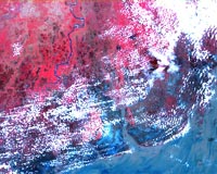
Images taken of Myanmar, using UK-DMC's 32 m resolution camera, show the disaster area in unprecedented detail.
DMC imagery acquired of the region is supplied to project managers of the International Charter "Space and Major Disasters" to be processed into information products that determine flood extents.
DMCii has also supplied pre-disaster archive imagery to enable comparisons with post-disaster imagery for the production of emergency maps.
Once the Burmese government allow UN planes carrying vital food supplies to land, UNOSAT will be able to use the satellite images to help direct both emergency services and aid to those areas most seriously affected.
DMICii is an SSTL company, based in Guildford UK which co-ordinates the Disaster Monitoring Constellation (DMC). The DMC currently operates four satellites owned by a consortium comprising CNTS Algeria (AlSAT-1), NSRDA Nigeria (NigeriaSat-1), BLMIT PR China (Beijing-1) and BNSC (UK-DMC).
Two more SSTL-built satellites will be launched into the DMC later this year – Deimos-1 for Spanish customer Deimos Space and UK-DMC-2 funded by SSTL. SSTL are currently building a further two DMC satellites for Nigeria, which will be launched in 2009.
