 |
Baton Rouge LA (SPX) Sep 10, 2010 Gregory Stone, director of LSU's WAVCIS Program and also of the Coastal Studies Institute in the university's School of the Coast and Environment, disagrees with published estimates that more than 75 percent of the oil from the Deepwater Horizon incident has disappeared. Stone recently participated in a three-hour flyover of the affected area in the Gulf, where he said that subsurface oil was easily visible from overhead. "It's most definitely there," said Stone. "It's just a matter of time before it makes itself known again." Readings from WAVCIS indicate that the direction of the ocean currents near the middle and bottom of the water column are aimed offshore; in other words, this submerged oil will be pushed out to sea, where it will then rise higher into the water column and be washed onto land, particularly during storms. "It is going to come on shore not consistently, but rather in pulses because it is beneath the surface," he said. "You may get one or two, maybe even five or 10 waves coming ashore with absolutely no oil ... but eventually, it's going to come ashore." He also cautions that whatever oil doesn't remain suspended in the water column may simply sit atop the seafloor, waiting to be mixed back into the currents. "It will simply be stirred up during rough seas or changing currents and reintroduced into the water column," he explained. Another timely concern is hurricane season since September is generally one of the most active months of the year. "Storm surge, when combined with storm waves from a hurricane, could stir up this submerged oil and bring it - lots of it - onshore and into the wetlands," Stone said. "Even a tropical storm could result in more oil on the shoreline. And that's a reality we need to consider and be prepared for." Formally known as the Wave-Current-Surge Information System, WAVCIS is based off of a network of buoys, oil platforms sensors and ADCPs, or Acoustic Doppler Current Profilers, in the Gulf of Mexico. The ADCPs are exceptionally sensitive. Housed on the seafloor, they send acoustic signals up to the surface of the water, measuring the entire water column for everything from current direction to speed and temperature. It's also integrated with the National Data Buoy Center, or NDBC, system, providing researchers worldwide with a comprehensive look at the Gulf environment, which is an invaluable research tool during the inevitable hurricane season, and also during disasters such as the Deepwater Horizon tragedy. "WAVCIS is among the most sensitive ocean observing systems in the entire nation," said Stone. "We measure a wide variety of physical parameters at the water surface, water column and on the sea bed. This information is extremely helpful in predicting or determining where the oil is - and where it's going to go. Because our information is updated hourly and available to the public, our lab has played a primary role in providing facts about the situation surrounding the oil's movement and location." Stone, whose experience with WAVCIS has spanned everything from natural to manmade disasters, knows that only time will tell the severity of the oil's impact. "This is a long term problem. It's not simply going to go away. I was in Prince William Sound 10 years after the Exxon-Valdez event, and when I lifted up a rock, there was still residual oil beneath it," he said. "Thus, the residence time of oil in the coastal environment can be substantial, although ecosystem conditions along the northern Gulf are very different and will likely recover quicker than in Alaska. We here at WAVCIS can at least track Gulf conditions to monitor the situation as closely as possible."
Share This Article With Planet Earth
Related Links WAVCIS Powering The World in the 21st Century at Energy-Daily.com
 US asks firms to reveal gas extraction liquid
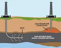
Washington (AFP) Sept 9, 2010 The US environmental regulator on Thursday asked gas companies to reveal what chemicals are used in deep extraction, addressing concerns by residents that their drinking water is being contaminated. US companies have increasingly tapped shale gas, which lies deep underground and was once thought inaccessible. Firms force out the gas through hydraulic fracturing, or fracking, in which a large ... read more |
|
| The content herein, unless otherwise known to be public domain, are Copyright 1995-2010 - SpaceDaily. AFP and UPI Wire Stories are copyright Agence France-Presse and United Press International. ESA Portal Reports are copyright European Space Agency. All NASA sourced material is public domain. Additional copyrights may apply in whole or part to other bona fide parties. Advertising does not imply endorsement,agreement or approval of any opinions, statements or information provided by SpaceDaily on any Web page published or hosted by SpaceDaily. Privacy Statement |